
Philippine government issues lahar alert anew amid heavy rains
Text by MINI ZAMORA-ARCEO | Photos by JOJO DUE and MZA
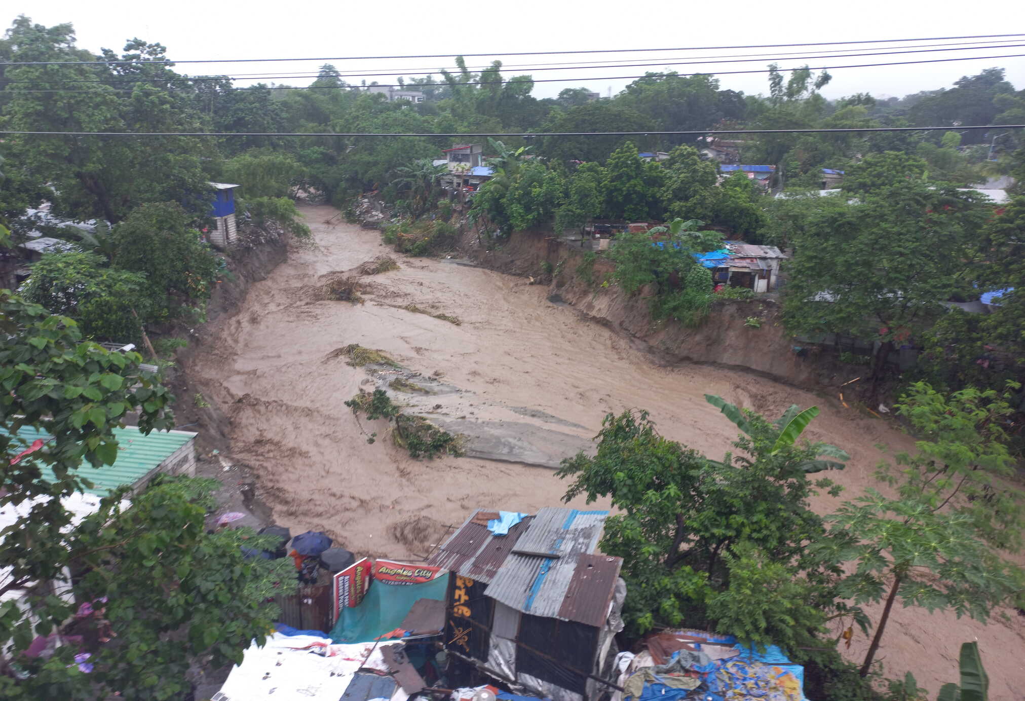
Communities downstream of Mount Pinatubo have been urged to remain vigilant as the continuous southwest monsoon rains could trigger lahar flows, muddy streamflows and flooding in areas surrounding the volcano.
In its Lahar Advisory for Pinatubo issued at 11 a.m. on August 29, 2026, the Philippine Institute of Volcanology and Seismology (PHIVOLCS) warned that prolonged and intense rainfall associated with the southwest monsoon could remobilize volcanic deposits left by the volcano’s catastrophic 1991 eruption.
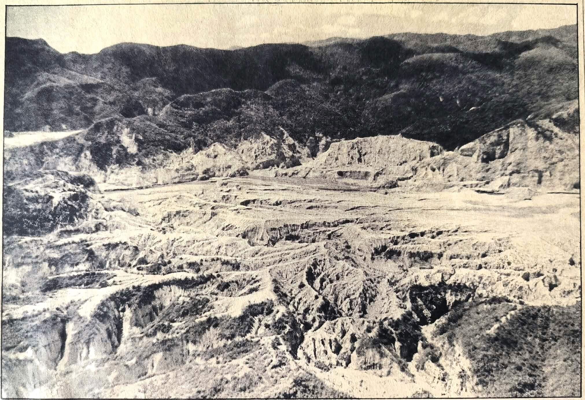
The Sacobia section of the Zambales mountain range with pyroclastic material in 1994. The volcanic material poses a threat anew to low-lying communities around Pinatubo volcano after PHIVOLCS issued a warning that the continuous heavy rainfall the past weeks caused by the Southwest monsoon could remobilized the pyroclastic materials into lahar flows.

Crossing lahar flows. Residents living near the Abacan River in Barangay Balibago, Angeles City ferry people wanting to cross the river to get the Balibago side from the Marisol side after the Abacan Bridge was destroyed by rampaging lahar flows following the eruption of Pinatubo volcano in 1991.
The warning was issued based on Philippine Atmospheric, Geophysical and Astronomical Services Administration’s (PAGASA) Heavy Rainfall Warning No. 15, which said southwest monsoon rains would continue to affect the western and central portions of Luzon.
PHIVOLCS said non-eruption lahars could develop along major rivers draining the western side of Mount Pinatubo, where substantial deposits from the 1991 pyroclastic density currents remain at the watershed.
The agency said lahars are likely to remain confined to river channels in the upper and middle reaches of the Sto. Tomas-Marella and Bucao river systems but could turn into muddy streamflows and floods downstream.
These flows could affect communities in San Marcelino, San Narciso, San Felipe and Botolan in Zambales province.
PHIVOLCS also said muddy streamflows could also develop along the O’Donnell and Pasig-Potrero river systems, which drain the northern and southeastern portions of Pinatubo and could affect downstream communities in Tarlac and Pampanga.




PHIVOLCS has urged communities and local government units in the identified hazard areas to continuously monitor weather conditions and undertake pre-emptive measures to protect lives and property.
The latest warning serves as a reminder that the danger posed by Pinatubo did not end with its massive eruption 35 years ago.
Before 1991, Mount Pinatubo had been dormant for roughly 500 years. Its awakening began with steam explosions on April 2, 1991, followed by increasing seismic activity and progressively larger eruptions.
On June 15, 1991, Pinatubo unleashed one of the largest volcanic eruptions of the 20th century and the second-largest eruption of that century. The climactic explosion produced enormous quantities of magma, ash and volcanic debris, while an eruption column rose about 40 kilometers into the atmosphere.
The eruption was so powerful that the summit collapsed, creating a caldera about 2.5 kilometers across. Pyroclastic flows — searing mixtures of volcanic gas, ash and rock—raced down the volcano’s slopes and filled valleys with deposits reaching as much as 200 meters thick in some places.
The volcanic deposits left behind by the 1991 eruption remain vulnerable to erosion during periods of intense rainfall. According to the U.S. Geological Survey, lahars have destroyed the homes of more than 100,000 people in communities around Pinatubo since the eruption.
Rainfall remains a key trigger. During the southwest monsoon and typhoon season, intense rain can rapidly erode loose volcanic deposits and carry these into river channels and downstream communities.
editor's pick
latest video


news via inbox
Nulla turp dis cursus. Integer liberos euismod pretium faucibua